| State | qld |
|---|---|
| Coordinates | 23.7691°S 148.1313°E |
| Zoom | 9 |
| Pop | 232 |
| Postcode | 4702 |
| Area | 1335.3 |
| Time zone | AEST |
| Utc | +10:00 |
| Dist 1 | 23.5 |
| Dir 1 | S |
| Location 1 | Emerald |
| Dist 2 | 290 |
| Dir 2 | WSW |
| Location 2 | Rockhampton |
| Dist 3 | 809 |
| Dir 3 | NW |
| Location 3 | Brisbane |
| Lga | Central Highlands Region |
| Stategov | Gregory |
| Fedgov | Flynn |
| Near-n | Emerald |
| Near-ne | Comet |
| Near-e | Comet |
| Near-se | Arcturus |
| Near-s | Minerva |
| Near-sw | Lochington |
| Near-w | Lochington |
| Near-nw | Anakie Siding |
Gindie is a rural locality in the Central Highlands Region, Queensland, Australia.[1] In the , Gindie had a population of 232 people.[2]
Geography
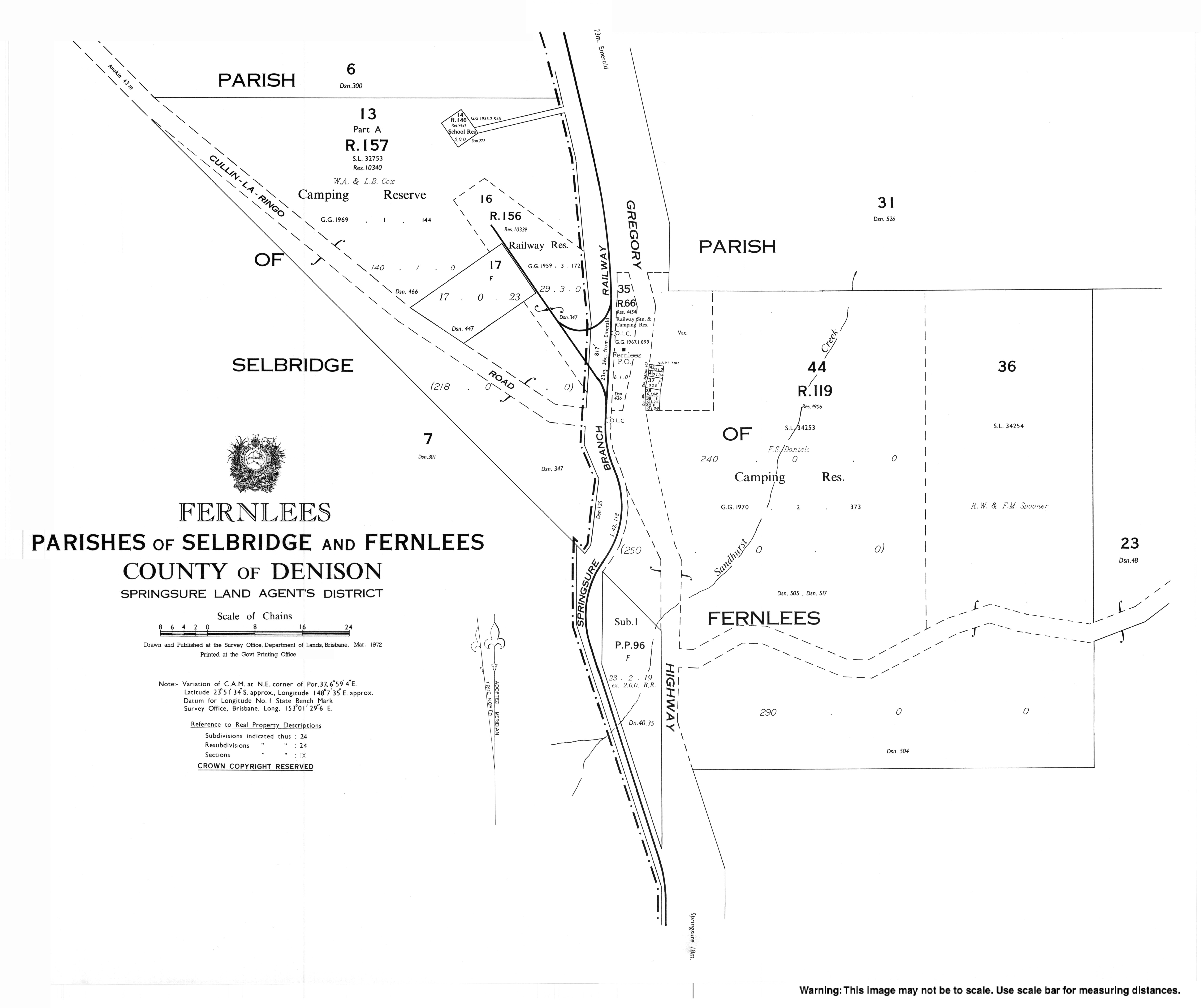
The settlement of Fernlees is located in southern Gindie (23.8567°S 148.125°E).[3][4]
The Gregory Highway passes through the locality from north (Emerald) to south (Minerva) passing through the town of Fernlees. The Blackwater railway line passes through the locality parallel and immediately east of the highway with a railway siding at Fernlees (23.8556°S 148.1242°E).[5]
History
The name Gindie means "much brigalow".[6]
Gindie Provisional School (also known as Gindie Siding Provisional School) opened 12 November 1897 with 25 students under head teacher Miss Mary E. Hamilton. It became Gindie State School on 1 January 1909. The school closed in 1949 but later reopened. In 1965, the school moved to a new site using a demountable building until a permanent building was completed in 1970.[7][8][9]
The Gindie State Farm was established In 1898 to experiment with growing new kinds of crops in the district such as sorghum, maize and pumpkins. The farm closed in 1932.[10]
Fernlees State School opened on 20 September 1951 and closed in 1953.[11] It was on a 2-acre (0.81-hectare) site off to the west the Gregory Highway north of the town (approx 23.8479°S 148.1214°E).[12][13]
Fernlees Methodist Church was established in 1959 at 2780 Gregory Highway (23.8564°S 148.1252°E). Following the amalgamation of the Methodist Church into the Uniting Church in Australia in 1977, it became the Fernlees Uniting Church. It closed in 2007. It is now a private residence.[14][15][16]
On 17 April 2020, the Queensland Government re-drew the boundaries of localities within the Central Highlands Region by replacing the locality of The Gemfields with three new localities of Rubyvale, Sapphire Central and Anakie Siding (around the towns of Rubyvale, Sapphire, and Anakie respectively). This included adjusting the boundaries of other existing localities in the Region to accommodate these changes; Gindie gaining the south-eastern corner of The Gemfields and gaining the eastern edge of Lochington, but losing a small area of its northern part and a small area from its north-east part to Anakie Siding, increasing the area of the locality from 1293.4 to 1335.3 km2.[17][18][19][4] As a consequence of these changes, Lake Maraboon is now entirely within the north-west of Gindie and the boundary between Lochington and Minerva/Gindie more closely follows the course of the Nogoa River.[4]
Demographics
In the , Gindie had a population of 382 people.[20]
In the , Gindie had a population of 209 people.[21]
In the , Gindie had a population of 232 people.[2]
Education
Gindie State School is a government primary (Prep-6) school for boys and girls at 14 Old Cullen-la-ringo Road (corner of Gregory Highway, 23.7242°S 148.1408°E).[22][23] In 2013, the school had an enrolment of 40 students in two classes, P-2 and 3-7, with 3 teachers (2 full-time equivalent).[24] In 2018, the school had an enrolment of 35 students with 4 teachers (3 full-time equivalent) and 8 non-teaching staff (2 full-time equivalent).[25]
Camp Fairbairn Outdoor Education Centre is an Outdoor and Environmental Education Centre at Fairbairn Dam (23.6645°S 148.092°E).[22] It has a principal, 3 teachers and 3 non-teaching staff.[26] It offers basic residential accommodation and outdoor programs for students from Prep to Year 12.[27]
There is are no secondary schools in Gindie. The nearest government secondary school is Emerald State High School in neighbouring Emerald to the north.[4]
References
- ^ Retrieved 7 July 2020.
- ^
- ^ Retrieved 29 December 2017.
- ^
- ^ Retrieved 17 July 2020.
- ^ "SKETCHER.". The Queenslander. 4 April 1914. p. 8. Archived 13 September 2021 at the Wayback Machine. Retrieved 5 July 2014. – via National Library of Australia.
- ^ Retrieved 4 July 2014.
- ^
- ^ "History". Gindie State School. 2020-01-14. Retrieved 2025-06-22.
- ^ "Emerald Shire". Queensland Places. Centre for the Government of Queensland, University of Queensland. Archived 12 October 2014 at the Wayback Machine. Retrieved 4 July 2014.
- ^ Queensland Family History Society (2010), Queensland schools past and present, Version 1.01 ed., Queensland Family History Society, ISBN 978-1-921171-26-0
- ^ "Town of Fernlees" (Map). Queensland Government. 1972. Retrieved 22 July 2022.
- ^
- ^ Blake, Thom. "Fernlees Methodist Church". Queensland religious places database. Archived 17 September 2021 at the Wayback Machine. Retrieved 2021-09-17.
- ^ "Gift of a Church – a mix of mission and service | Emerald Uniting Church". Archived 23 March 2021 at the Wayback Machine. Retrieved 2021-09-17.
- ^ "Emerald Uniting Church". Churches Australia. Archived 17 September 2021 at the Wayback Machine. Retrieved 2021-09-17.
- ^ "Recent place name decisions: Job number 18-115: The Gemfields". Queensland Government. 17 April 2020. Archived 17 July 2020 at the Wayback Machine. Retrieved 17 July 2020.
- ^ "Proposed Locality Boundaries and Names: Anakie Siding, Argyll, Emerald, Gindie, Lochington, Minerva, Rubyvale and Sapphire Central". Queensland Government. 2019. Archived 17 July 2020 at the Wayback Machine. Retrieved 17 July 2020.
- ^ "Locality Boundaries and Names: Anakie Siding, Argyll, Emerald, Gindie, Lochington, Minerva, Rubyvale and Sapphire Central". Queensland Government. 17 April 2020. Archived 17 July 2020 at the Wayback Machine. Retrieved 17 July 2020.
- ^
- ^
- ^ "State and non-state school details". Queensland Government. 9 July 2018. Archived 21 November 2018 at the Wayback Machine. Retrieved 21 November 2018.
- ^ "Gindie State School". Archived 15 March 2020 at the Wayback Machine. Retrieved 21 November 2018.
- ^ "2013 School Annual Report". Gindie State School. Archived 14 July 2014 at the Wayback Machine. Retrieved 5 July 2014.
- ^ "ACARA School Profile 2018". Australian Curriculum, Assessment and Reporting Authority. Archived 27 August 2020 at the Wayback Machine. Retrieved 28 January 2020.
- ^ "Camp Fairbairn Outdoor Education Centre". Archived 17 July 2020 at the Wayback Machine. Retrieved 17 July 2020.
- ^ "About us". Camp Fairbairn Outdoor Education Centre. 2019-05-20. Archived 23 February 2021 at the Wayback Machine. Retrieved 2020-07-17.
Further reading
- Gindie State School (Qld.). Centenary of Education Committee (1997), Our school on the black soil plain : an account of 100 years of education at Gindie State School, Central Queensland, The School, ISBN 978-0-7242-7817-6
- Daniels Family Reunion & 100 years of Settlement at Gindie Committee. History Sub-committee (1996), Gindie, a place to call home : the Daniels family history including their emigration from London, their lives on the Darling Downs and 100 years of mixed farming on the Central Highlands, The Daniels Family Reunion & 100 Years of Settlement at Gindie Committee, ISBN 978-0-646-26622-0
External links
- "Town map of Fernlees". Queensland Government. 1972. Archived 17 July 2020 at the Wayback Machine.
